![]()
Home
Mission
Overview of Project
Project Staff
Sponsors
Achievements
Checking, Illustrations
Upcoming Activities
Id and Species Lists
Protea Information
Protea Gallery
Growing Proteas
Interim Dist. Maps
Publications
Afrikaanse Inligting
![]()
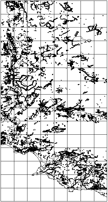
Areas requiring additional Atlassing
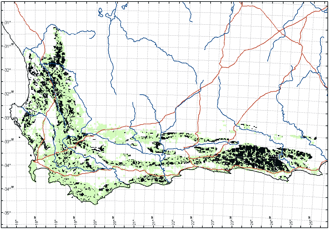
![]() There are a number of
priority (under atlassed) areas in the Cape Fynbos region that should still be atlassed.
There are a number of
priority (under atlassed) areas in the Cape Fynbos region that should still be atlassed.
The key of the below map is:
Light Green - Atlassed minute by minute cells with pristine Fynbos
Black - Unatlassed cells with more than 50% pristine Fynbos (please visit these sites and atlas them)
Red - Major Roads
Blue - Major Rivers
Thus the black areas are areas that we have missed during atlassing. Any area with more than 10 contiguous black blocks must be considered a major gap. Areas not grey or black are not expected to have any proteas. Compare to the Null SRS map in PAN 53.
Each block is 1’ x 1’ in size, or roughly 1.5 x 1.5 km.
Alternatively, you may download the Priority shapefiles and then load them into ArcExplorer (see http://www.esri.com or get the Protea Atlas SRS Database which distributes ESRI's ArcEcplorer light weight GIS under licence) or any other GIS and view more precisely just where these priority areas are.
Cape Fynbos Priority areas to be Atlassed
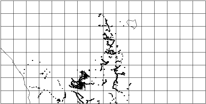
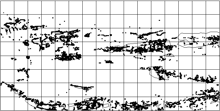
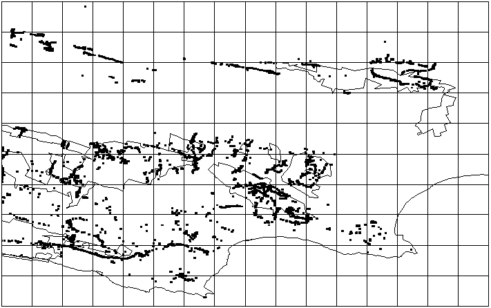
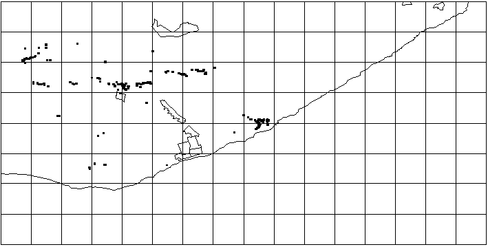
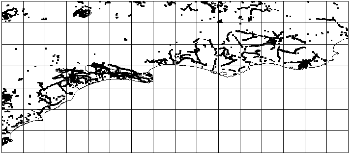
Here are maps that document areas that have been atlassed. Please visit those areas where there are holes and therefore do not have any black dots.
3118 Calvinia
3218 Clanwilliam
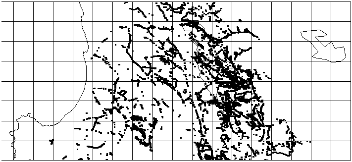
3318 Cape Town
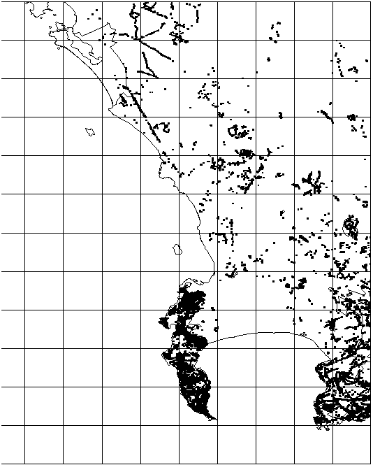
3319 Worcester
3320 Ladismith
3322 Oudtshoorn
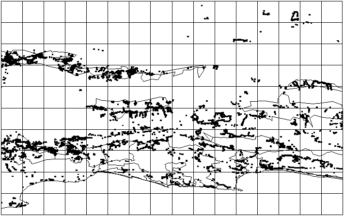
3324 Port Eilizabeth
3326 Grahamstown
3420 Riversdale
Back What Now?